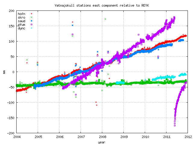
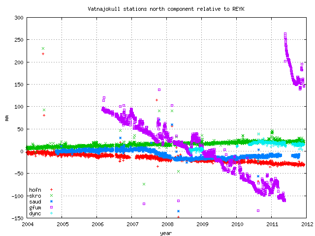
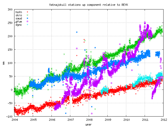
Continuous GPS measurements
Posted by JAC on 4/18/2010, 8:16 pm
62
In this thread:
Iceland earthquakes - CypressTX, 4/18/2010, 5:12 pm
- Harmonic Tremor at the SE side of Katla - JAC, 4/18/2010, 8:04 pm
- Harmonic Katla - Target, 4/19/2010, 12:10 am
- Harmonic Katla - Target, 4/18/2010, 11:24 pm
- Tjornes Fracture Zone - JAC, 4/18/2010, 7:15 pm
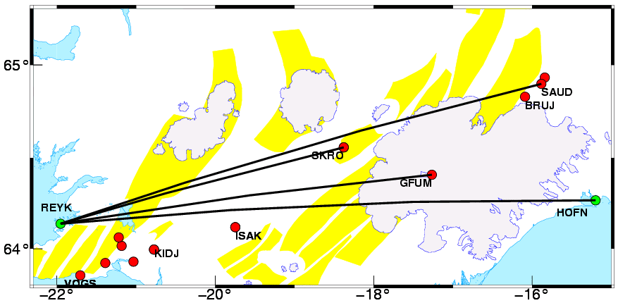
- Vatnajokull - on the north end of Iceland's biggest glacier - JAC, 4/18/2010, 7:12 pm
- Actually it looks like Bardarbunga is where the swarm is occuring - JAC, 4/18/2010, 8:02 pm
- Kverkfjoll is the volcano on the north end of the glacier - JAC, 4/18/2010, 7:51 pm
- Grimsvotn (Iceland's Deadliest Volcano) is in the middle of Vatnajokull Glacier - JAC, 4/18/2010, 7:36 pm
- Caldera comparisons - JAC, 4/18/2010, 7:44 pm
- Re: Iceland earthquakes - JAC, 4/18/2010, 6:49 pm
- tks n/t - CypressTX, 4/18/2010, 7:04 pm
Post A Reply
This thread has been archived and can no longer receive replies.