Global Tropical Hazards Assessment Discussion
Posted by JAC on 6/15/2011, 2:03 pm


Last Updated: 06.14.11  

Valid: 06.15.11 - 06.28.11

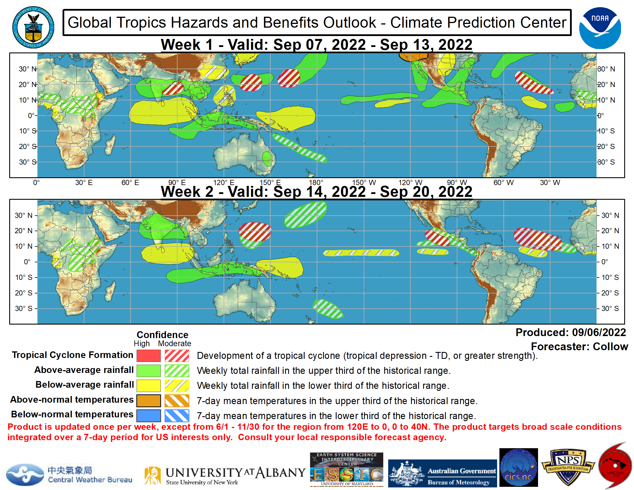
The most coherent tropical variability during the past week remains atmospheric Kelvin wave activity. Observations indicate two separate Kelvin waves are impacting the tropical convection. One resulted in enhanced rainfall across parts of Africa during the past week and another is entering the central Pacific and beginning to excite convection across the Pacific ITCZ. The MJO remains weak, although there are some impacts especially across parts of the eastern hemisphere. ENSO neutral conditions have officially been declared as SSTs no longer meet La Nina criteria. La Nina features do remain in some atmospheric variables, however, especially in upper-level winds across the central Pacific. Enhanced rainfall was evident during the past week stretching from the Arabian Sea across India, parts of Southeast Asia to east of the Philippines. Drier-than-average conditions continued across Mexico and the southern CONUS. The heavy rainfall across the Caribbean over the last 1-2 weeks ended early in the week.

During Week-1, the combination of a weak MJO enhanced convective phase, an atmospheric Kelvin wave and forecast above-normal Indian-Asian monsoon activity favor enhanced chances for above-average rainfall stretching from India to the western Pacific in a northwest-southeast orientation. Drier than average conditions are most likely south of this area and is supported by forecast model guidance. A few disturbances near the Philippines currently and generally weak vertical wind shear favor tropical cyclogenesis for both the South China Sea and far western Pacific. during the period. Forecast model guidance favors drier-than average conditions to continue across Mexico as the North American monsoon system is late in intensifying. The Caribbean is also forecast to see beneficial drier than average conditions during the period. An atmospheric Kelvin wave entering the central Pacific is expected to enhance the eastern Pacific ITCZ late this week into early next week and this along with below-average vertical wind shear favors potential development.

As we move into Week-2, an active Indian monsoon favors a continuation of enhanced rainfall for India and the Bay of Bengal. Forecast model guidance also continues to indicate enhance rainfall near the Philippines. The potential for tropical storm development also remains elevated near the Philippine islands. Model forecast guidance suggests a change across the southern areas of the North American monsoon region and northern Central America during the period to increased chances for above-average rainfall. Further tropical development is possible into Week-2 across the eastern Pacific basin.

There is also some threat for potential tropical development in the Bay of Campeche during the period. Model guidance indicates a disturbance moving northward toward the Gulf coast potentially providing beneficial rainfall drought parched areas of the souther U.S.. The potential at the current time for this is low, however.


http://www.cpc.ncep.noaa.gov/products/precip/CWlink/ghazards/
125
In this thread:
BOC Mid-Level Development possible late next week - JAC, 6/15/2011, 1:57 pm
< Return to the front page of the: message board | monthly archive this page is in
Post A Reply
This thread has been archived and can no longer receive replies.