Re: OPC's Sandy support page
Posted by cypresstx on 10/28/2012, 8:56 am
141
In this thread:
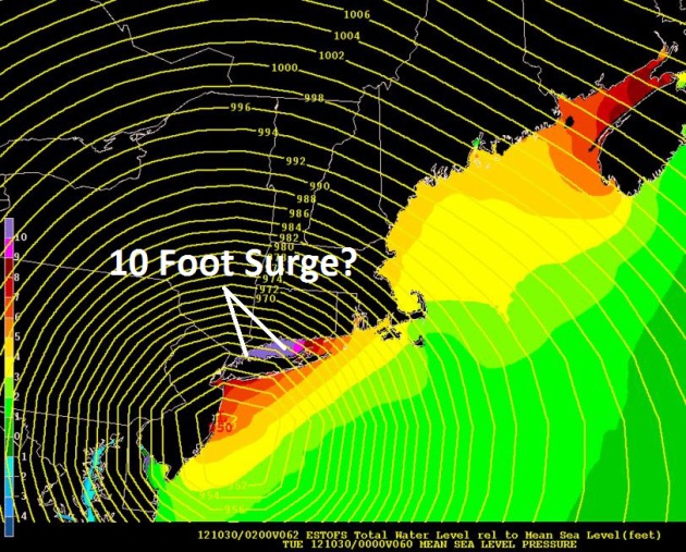
Long Island Sound & Raritan Bay including New York Harbor surge predictions for Sandy now 6 to 11ft - Chris in Tampa, 10/28/2012, 8:13 am
- OPC's Sandy support page - cypresstx, 10/28/2012, 8:35 am
- Re: OPC's Sandy support page - hanna, 10/28/2012, 11:41 am
- Re: OPC's Sandy support page - martyintampa, 10/28/2012, 12:09 pm
- Re: OPC's Sandy support page - hanna, 10/28/2012, 11:41 am
Post A Reply
This thread has been archived and can no longer receive replies.