Earth Observatory views of Sandy etc
Posted by
hanna on 10/28/2012, 11:16 pm
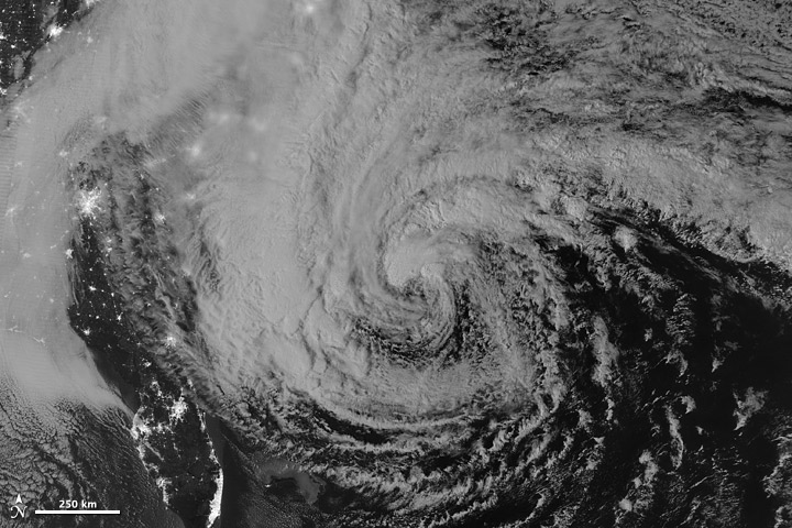
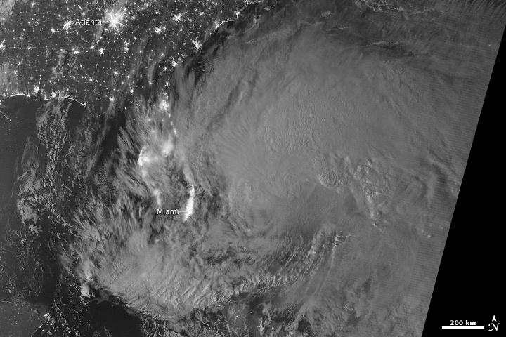
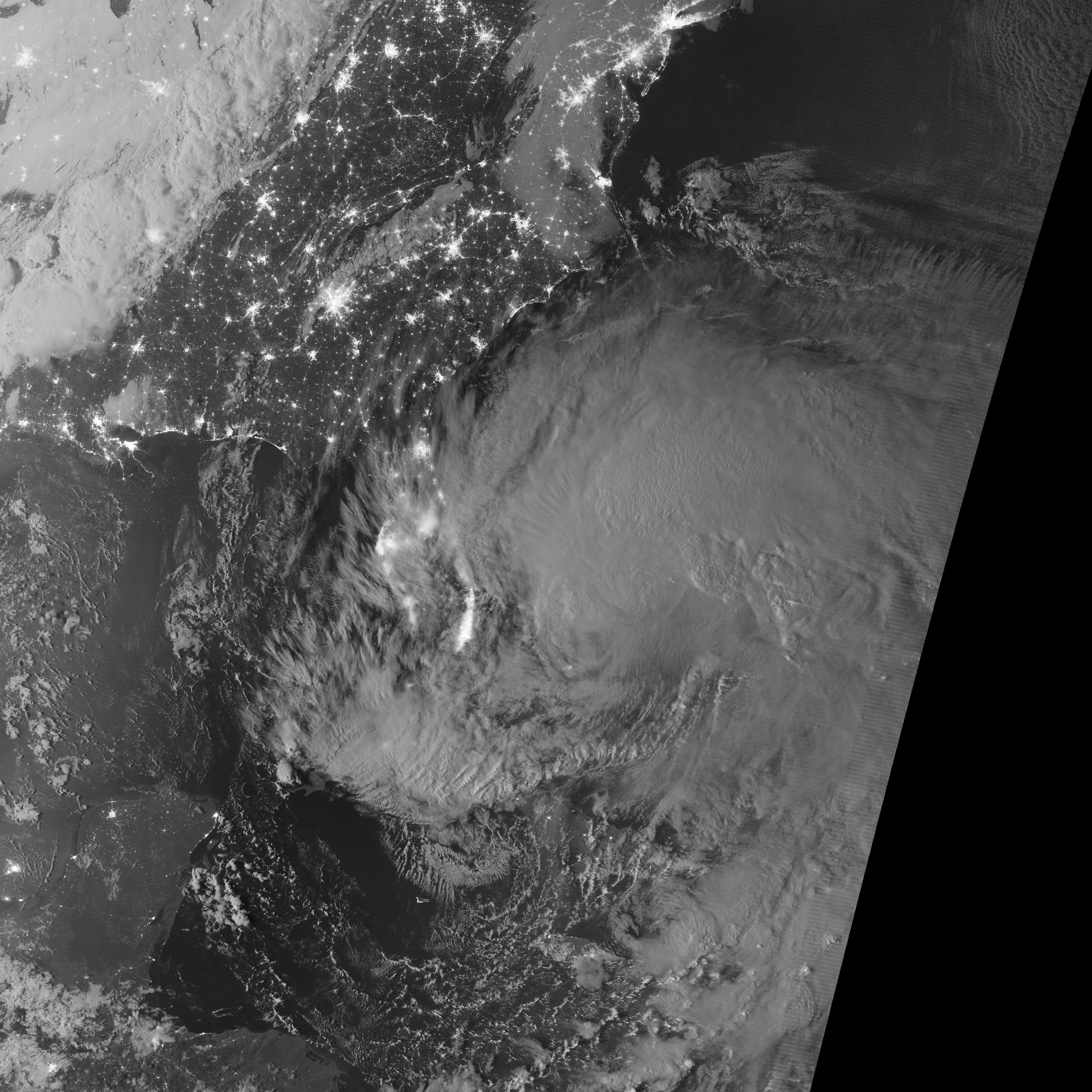
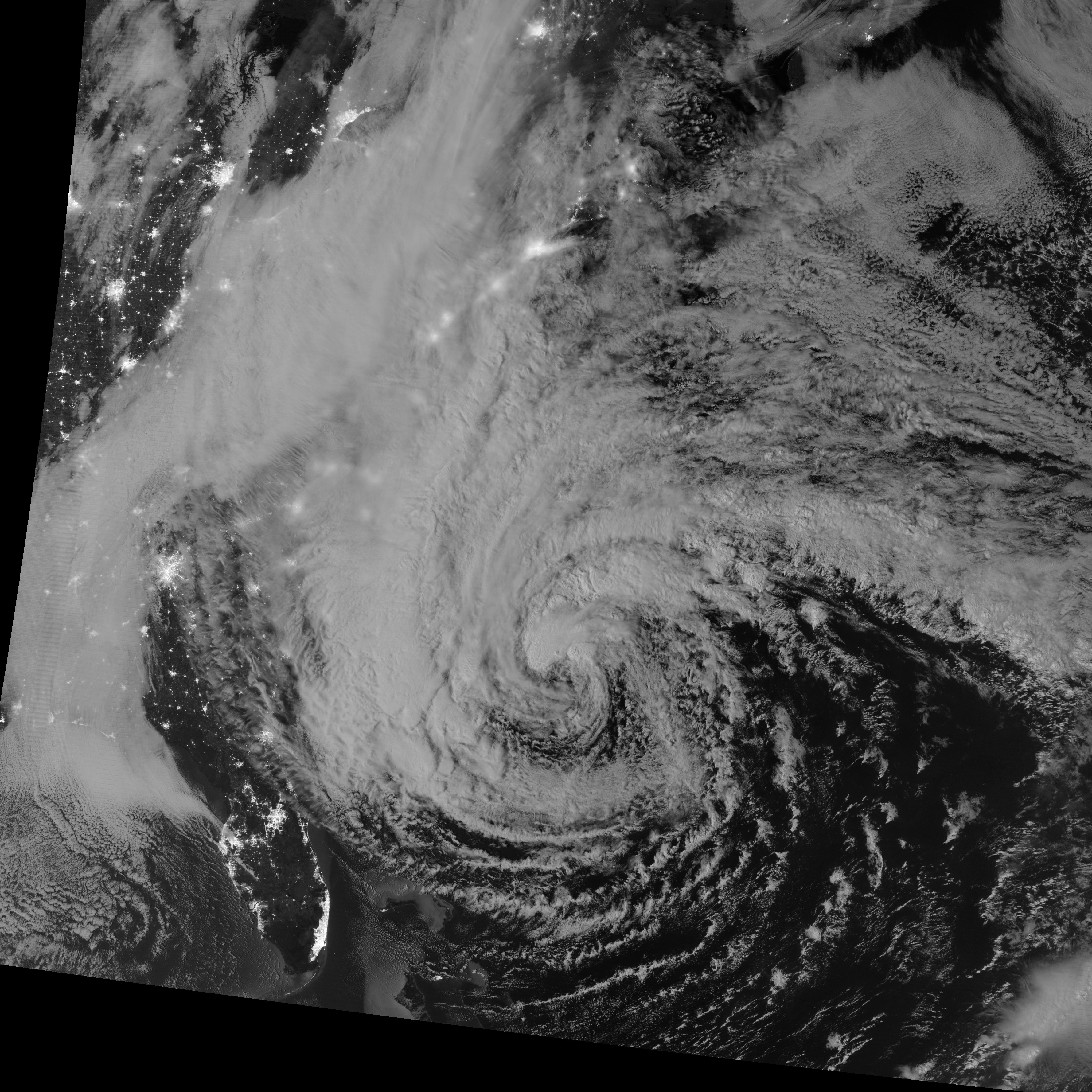
This image of Hurricane Sandy was acquired by the Visible Infrared Imaging Radiometer Suite (VIIRS) on the Suomi NPP satellite around 2:42 a.m. Eastern Daylight Time (06:42 Universal Time) on October 28, 2012. Suomi NPP was launched one year ago today on a mission to extend and enhance long-term records of key environmental data.
The storm was captured by a special "day-night band," which detects light in a range of wavelengths from green to near-infrared and uses filtering techniques to observe dim signals such as auroras, airglow, gas flares, city lights, fires, and reflected moonlight. In this case, the cloud tops were lit by the nearly full Moon (full occurs on October 29). Some city lights in Florida and Georgia are also visible through the clouds.
For more information: http://earthobservatory.nasa.gov/IOTD/view.php?id=79545
Fore more images: http://earthobservatory.nasa.gov/NaturalHazards/event.php?id=79504 |
176
In this thread:
Earth Observatory views of Sandy etc - hanna, 10/28/2012, 11:16 pm Post A Reply
This thread has been archived and can no longer receive replies.