O/T but related. Drifter Buoys Provide Ground Truth for Climate Data
Posted by
hanna on 7/7/2013, 10:06 am
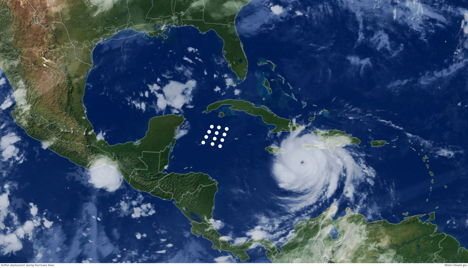
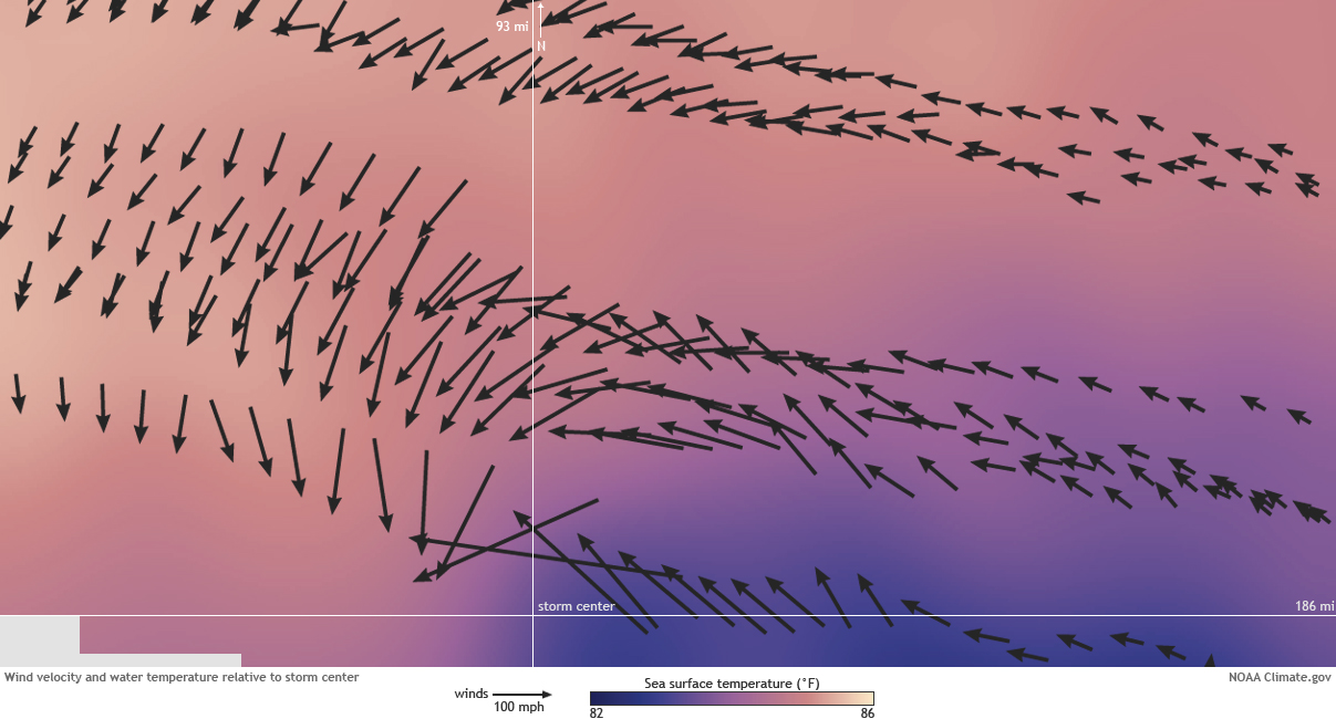
(top) Location of drifters (image center) overlaid on a NOAA satellite image of Hurricane Dean on August 19, 2007. (bottom) The drifters measured wind speed and direction (arrows) as well as water temperature as the hurricane traveled toward Mexico's Yucatan Peninsula. Scientists studied Dean's intensification by plotting the drifter observations over several days in late August, using a moving frame of reference centered on the eye of the storm. Images by NOAA Climate.gov team, adapted from originals by Rick Lumpkin, AOML.
For the full story. http://www.climate.gov/news-features/climate-tech/doing-their-part-drifter-buoys-provide-ground-truth-climate-data |
76
In this thread:
O/T but related. Drifter Buoys Provide Ground Truth for Climate Data - hanna, 7/7/2013, 10:06 am
Post A Reply
This thread has been archived and can no longer receive replies.