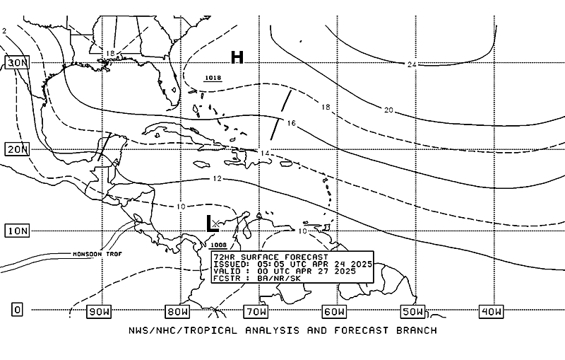
something to watch
Posted by cypresstx on 9/23/2015, 10:11 am
174
In this thread:
still watching the gulf... - cypresstx, 9/17/2015, 7:30 am
- 99L Spaghetti Models - Future Joaquin? - tvsteve, 9/26/2015, 4:35 pm
- Pouch 94L - cypresstx, 9/25/2015, 10:29 pm
- meant P45L n/t - cypresstx, 9/25/2015, 10:31 pm
- Invest 92E - cypresstx, 9/24/2015, 11:11 am
- Re: still watching the gulf... - freesong, 9/17/2015, 10:27 pm
- Re: still watching the gulf... - beachman80, 9/17/2015, 9:11 am
- Re: still watching the gulf... - Chris in Tampa, 9/17/2015, 8:12 am
- Re: still watching the gulf... - cypresstx, 9/17/2015, 8:31 am
- Re: still watching the gulf... - Chris in Tampa, 9/17/2015, 10:08 am
- Re: still watching the gulf... - jimw, 9/17/2015, 5:26 pm
- Re: still watching the gulf... - Beachlover, 9/22/2015, 2:20 pm
- Re: still watching the gulf... - cypresstx, 9/22/2015, 6:18 pm
- Re: still watching the gulf... - Beachlover, 9/23/2015, 2:42 am
- Re: still watching the gulf... - Chris in Tampa, 9/23/2015, 3:26 am
- Re: still watching the gulf... - Chris in Tampa, 9/23/2015, 5:57 pm
- on Tcgen day-5 loop - cypresstx, 9/24/2015, 8:19 am
- Re: something to watch - Chris in Tampa, 9/23/2015, 10:17 pm
- Re: something to watch - Beachlover, 9/24/2015, 1:15 am
- Re: something to watch - freesong, 9/23/2015, 11:29 pm
- Re: something to watch - Chris in Tampa, 9/24/2015, 2:37 am
- Re: something to watch - freesong, 9/24/2015, 7:45 am
- Re: something to watch - LawKat, 9/24/2015, 9:56 am
- Re: something to watch - freesong, 9/24/2015, 7:45 am
- Re: something to watch - Chris in Tampa, 9/24/2015, 2:37 am
- Re: something to watch - Chris in Tampa, 9/23/2015, 10:17 pm
- Re: still watching the gulf... - Chris in Tampa, 9/23/2015, 5:57 pm
- Re: still watching the gulf... - Chris in Tampa, 9/23/2015, 3:26 am
- Re: still watching the gulf... - Beachlover, 9/23/2015, 2:42 am
- Re: still watching the gulf... - cypresstx, 9/22/2015, 6:18 pm
- still at 10/30% at 8pm TWO - cypresstx, 9/17/2015, 7:42 pm
- 20/40% at 8am TWO - cypresstx, 9/18/2015, 8:26 am
- JAX: gust to 41 mph this am - cypresstx, 9/18/2015, 8:34 am
- 20/40% at 8am TWO - cypresstx, 9/18/2015, 8:26 am
- Re: still watching the gulf... - Beachlover, 9/22/2015, 2:20 pm
- Re: still watching the gulf... - jimw, 9/17/2015, 5:26 pm
- Re: still watching the gulf... - Chris in Tampa, 9/17/2015, 10:08 am
- Re: still watching the gulf... - cypresstx, 9/17/2015, 8:31 am
Post A Reply
This thread has been archived and can no longer receive replies.

