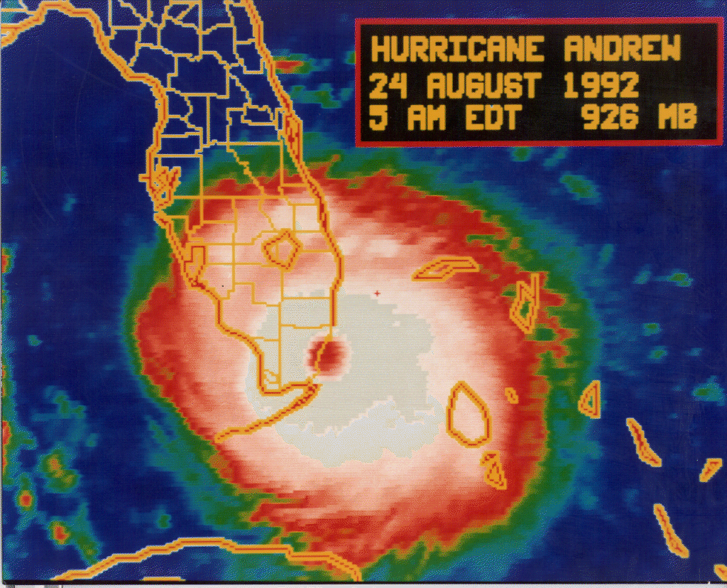
GFS, Wow... A good time to visit friends out of State?
Posted by Target on 9/4/2017, 2:18 am
53
In this thread:
5pm AST Sun: 115mph; W (260 degrees) at 14mph; Hurricane watches issued for parts of Leewards - Chris in Tampa, 9/3/2017, 5:05 pm
- Re: 5pm AST Sun: 115mph; W (260 degrees) at 14mph; Hurricane watches issued for parts of Leewards - stevemc12, 9/4/2017, 3:07 am
- Re: 5pm AST Sun: 115mph; W (260 degrees) at 14mph; Hurricane watches issued for parts of Leewards - stevemc12, 9/4/2017, 2:51 am
- Re: 5pm AST Sun: 115mph; W (260 degrees) at 14mph; Hurricane watches issued for parts of Leeward - Target, 9/4/2017, 3:21 am
- Re: 5pm AST Sun: 115mph; W (260 degrees) at 14mph; Hurricane watches issued for parts of Leeward - Big Scott 76, 9/4/2017, 3:43 am
- Re: 5pm AST Sun: 115mph; W (260 degrees) at 14mph; Hurricane watches issued for parts of Leeward - Target, 9/4/2017, 3:21 am
- 0z GFS moves CAT 5 hurricane into Florida - Big Scott 76, 9/4/2017, 12:53 am
- Re: 0z GFS moves CAT 5 hurricane into Florida - stevemc12, 9/4/2017, 1:04 am
- A bit of a Model Shift tonight - beachman80, 9/3/2017, 10:27 pm
- Re: A bit of a Model Shift tonight - Shalista, 9/4/2017, 12:04 am
- Re: A bit of a Model Shift tonight - stevemc12, 9/4/2017, 12:48 am
- Re: A bit of a Model Shift tonight - Shalista, 9/4/2017, 12:04 am
- Radar loop of NOAA hurricane hunters' first mission - Chris in Tampa, 9/3/2017, 9:47 pm
- GFS ensemble models - Big Scott 76, 9/3/2017, 8:49 pm
- Re: GFS ensemble models - beachman80, 9/3/2017, 9:04 pm
- Re: GFS ensemble models - Big Scott 76, 9/3/2017, 9:10 pm
- Re: GFS ensemble models - LawKat, 9/3/2017, 10:55 pm
- Re: GFS ensemble models - jachba, 9/3/2017, 11:54 pm
- Re: GFS ensemble models - POCTX, 9/4/2017, 1:59 am
- Re: GFS ensemble models - jachba, 9/3/2017, 11:54 pm
- Re: GFS ensemble models - LawKat, 9/3/2017, 10:55 pm
- Re: GFS ensemble models - Big Scott 76, 9/3/2017, 9:10 pm
- Re: GFS ensemble models - beachman80, 9/3/2017, 9:04 pm
- Re: 5pm AST Sun: 115mph; W (260 degrees) at 14mph; Hurricane watches issued for parts of Leewards - Big Scott 76, 9/3/2017, 8:43 pm
- Image of 18Z Sunday GFS Ensembles - Chris in Tampa, 9/3/2017, 8:46 pm
- GFS: 881mb at Landfall? - Target, 9/4/2017, 2:40 am
- Re: GFS: 881mb at Landfall? - stevemc12, 9/4/2017, 2:47 am
- Re: GFS, Wow... A good time to visit friends out of State? - stevemc12, 9/4/2017, 2:29 am
- GFS: 881mb at Landfall? - Target, 9/4/2017, 2:40 am
- Image of 18Z Sunday GFS Ensembles - Chris in Tampa, 9/3/2017, 8:46 pm
- 8:03pm EDT Vortex: Closed 25 nautical mile wide eye - Chris in Tampa, 9/3/2017, 8:41 pm
- Weather Prediction Center Medium Range Forecast - Chris in Tampa, 9/3/2017, 8:30 pm
- Umm...Cat 6?! - karen, 9/3/2017, 8:57 pm
- Cat 6 is new name of Jeff Masters and Bob Henson's blog - Chris in Tampa, 9/3/2017, 9:06 pm
- new name...whew! Thanks! LOL. n/t - karen, 9/3/2017, 9:34 pm
- Cat 6 is new name of Jeff Masters and Bob Henson's blog - Chris in Tampa, 9/3/2017, 9:06 pm
- Umm...Cat 6?! - karen, 9/3/2017, 8:57 pm
- 8pm AST Sunday: "Irma expected to be near the northern Leeward Islands by late Tuesday" - Chris in Tampa, 9/3/2017, 8:17 pm
- First Vortex Message: 961mb; 11 knots of surface wind - Chris in Tampa, 9/3/2017, 5:51 pm
- Recon image through 5:51pm EDT - Chris in Tampa, 9/3/2017, 5:58 pm
- Radar image from center of Irma at 5:16:49pm EDT Sunday - Chris in Tampa, 9/3/2017, 5:28 pm
- 10 second estimated surface wind by SFMR instrument was 98 knots (113mph) in NE quadrant - Chris in Tampa, 9/3/2017, 5:47 pm
- Re: 5pm AST Sun: 115mph; W (260 degrees) at 14mph; Hurricane watches issued for parts of Leewards - Shalista, 9/3/2017, 5:09 pm
- Re: 5pm AST Sun: 115mph; W (260 degrees) at 14mph; Hurricane watches issued for parts of Leeward - Chris in Tampa, 9/3/2017, 5:16 pm
- Re: 5pm AST Sun: 115mph; W (260 degrees) at 14mph; Hurricane watches issued for parts of Leewards - AquaRN, 9/3/2017, 5:08 pm
- Re: 5pm AST Sun: 115mph; W (260 degrees) at 14mph; Hurricane watches issued for parts of Leeward - stevemc12, 9/3/2017, 5:19 pm
Post A Reply
This thread has been archived and can no longer receive replies.

