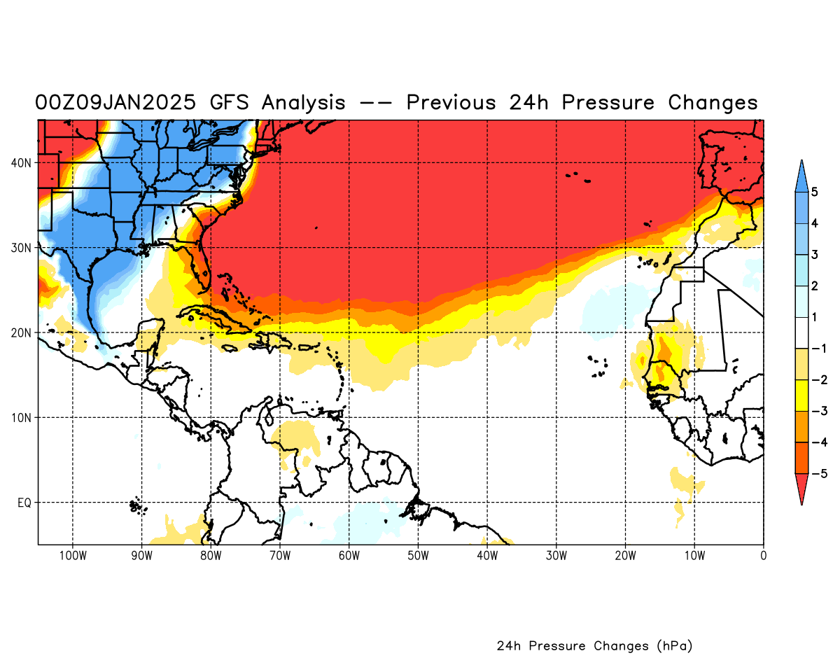
GFS pressure change analysis
Posted by cypresstx on 7/22/2019, 12:41 pm
46
In this thread:
Invest 94L - Just east of the Bahamas - Chris in Tampa, 7/21/2019, 12:18 pm
- Re: Invest 94L - Just east of the Bahamas - Beachlover, 7/21/2019, 5:31 pm
- Re: Invest 94L - Just east of the Bahamas - jimw, 7/22/2019, 6:07 am
- Thanks, Jim and Chris - karen, 7/22/2019, 8:53 am
- bumped up to 30/30% in 2/5-day - recon scheduled - cypresstx, 7/22/2019, 12:21 pm
- now 60/60% over 2/5 days - cypresstx, 7/22/2019, 3:53 pm
- bumped up to 30/30% in 2/5-day - recon scheduled - cypresstx, 7/22/2019, 12:21 pm
- Thanks, Jim and Chris - karen, 7/22/2019, 8:53 am
- Re: Invest 94L - Just east of the Bahamas - jimw, 7/22/2019, 6:07 am
Post A Reply
This thread has been archived and can no longer receive replies.