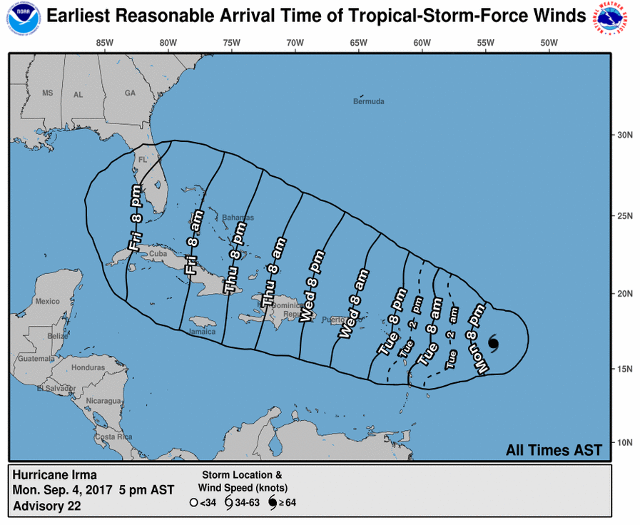
3-4pm Model Runs - models NOT yet in agreement - TS winds could arrive in Florida as early as Friday
Posted by tvsteve on 9/4/2017, 5:09 pm

179
In this thread:
5pm AST Mon: 130mph; CAT 4; 944mb; W at 13mph - tvsteve, 9/4/2017, 5:02 pm
- 5pm Wind Field Forecast - tvsteve, 9/4/2017, 6:54 pm
- Re: 3-4pm Model Runs - models NOT yet in agreement - TS winds could arrive in Florida as early as Fr - Gianmarc, 9/4/2017, 5:18 pm
- Re: 3-4pm Model Runs - models NOT yet in agreement - TS winds could arrive in Florida as early a - CX, 9/4/2017, 5:23 pm
- Re: 3-4pm Model Runs - models NOT yet in agreement - TS winds could arrive in Florida as early a - Chris in Tampa, 9/4/2017, 5:37 pm
- Re: 3-4pm Model Runs - models NOT yet in agreement - TS winds could arrive in Florida as early a - Beachlover, 9/4/2017, 5:42 pm
- Re: 3-4pm Model Runs - models NOT yet in agreement - TS winds could arrive in Florida as early a - Chris in Tampa, 9/4/2017, 5:37 pm
- Re: 3-4pm Model Runs - models NOT yet in agreement - TS winds could arrive in Florida as early a - CX, 9/4/2017, 5:23 pm
- Re: 3-4pm Model Runs - models NOT yet in agreement - TS winds could arrive in Florida as early as Fr - Gianmarc, 9/4/2017, 5:18 pm
Post A Reply
This thread has been archived and can no longer receive replies.