11am EDT Wed on Idalia: 90mph; 971mb; NNE at 20 mph
Posted by cypresstx on 8/30/2023, 11:07 am
https://www.nhc.noaa.gov/#Idalia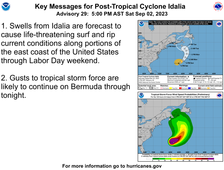 Hurricane Idalia Discussion Number 16...Retransmitted NWS National Hurricane Center Miami FL AL102023 1100 AM EDT Wed Aug 30 2023 Although Idalia reached category 4 intensity early this morning over the far northeastern Gulf of Mexico, Air Force Reserve Hurricane Hunter data just before landfall indicated that the peak winds had started to decrease and the minimum pressure had begun to rise. This was likely due to an eyewall replacement cycle (which was shown by radar data) and an increase in shear over the hurricane. Idalia made landfall near Keaton Beach, Florida, as a category 3 hurricane around 1145 UTC, and it has been weakening quickly since then over northern Florida. WSR-88D Doppler velocities suggest that the maximum winds are now down to about 80 kt. Idalia is moving toward the north-northeast, or 030/17 kt. The hurricane is located between a subtropical ridging near the Greater Antilles and a deep-layer trough over the eastern United States. This pattern is expected to cause Idalia to turn toward the northeast and then east during the next 36 hours, and the track guidance is very good agreement on the center moving near the coasts of Georgia, South Carolina, and North Carolina through Thursday. Model spread increases beyond 36 hours, although there is not as much uncertainty as yesterday. None of the models shows the circulation curving back toward the U.S. anymore, but the guidance is suggestive that Idalia will likely slow down as it approaches Bermuda on days 3 through 5. During that period, the NHC track forecast is a blend of the previous forecast with the current HCCA and TVCX consensus aids. Relatively fast weakening is anticipated through the rest of the day. The intensity guidance is hovering right around the hurricane threshold at 12 hours, and the official forecast therefore conservatively shows a 65-kt hurricane near the Georgia/South Carolina border this evening. Idalia should become a tropical storm by tonight while moving near the coast of South Carolina. The intensity forecast is a little bit above the guidance at 24 and 36 hours to account for the possibility of a band of strong winds developing on the back side of Idalia near eastern North Carolina, associated with a nearby frontal boundary. Beyond 36 hours, the guidance suggests that Idalia's intensity is likely to hover between 45-50 kt through the end of the forecast period. KEY MESSAGES: 1. Significant impacts from storm surge will continue along the Gulf coast of Florida within the Storm Surge Warning through this evening. Dangerous storm surge is also expected along the southeastern U.S. coast within the Storm Surge Warning area tonight and Thursday. Residents in these areas should follow any advice given by local officials. 2. Damaging hurricane-force winds will occur where the core of Idalia moves across southern Georgia and southern South Carolina within the hurricane warning area through this evening. Residents in these areas should be prepared for long-duration power outages. Strong winds are also expected to spread northeastward across South Carolina and North Carolina through Thursday within the Tropical Storm Warning area. 3. Areas of flash, urban, and moderate river flooding, with considerable impacts, are expected from portions of North Florida through central Georgia and South Carolina, through eastern North Carolina into Thursday. FORECAST POSITIONS AND MAX WINDS INIT 30/1500Z 30.6N 83.2W 80 KT 90 MPH...INLAND 12H 31/0000Z 32.4N 81.1W 65 KT 75 MPH...INLAND 24H 31/1200Z 33.8N 77.6W 55 KT 65 MPH...OVER WATER 36H 01/0000Z 33.9N 74.0W 50 KT 60 MPH 48H 01/1200Z 33.2N 71.1W 45 KT 50 MPH 60H 02/0000Z 32.4N 69.1W 45 KT 50 MPH 72H 02/1200Z 31.9N 68.0W 50 KT 60 MPH 96H 03/1200Z 31.4N 66.3W 50 KT 60 MPH 120H 04/1200Z 32.5N 63.3W 50 KT 60 MPH $$ Forecaster Berg BULLETIN Hurricane Idalia Advisory Number 16 NWS National Hurricane Center Miami FL AL102023 1100 AM EDT Wed Aug 30 2023 ...CENTER OF IDALIA CROSSING INTO SOUTHERN GEORGIA... ...HIGH WATER LEVELS CONTINUE ALONG THE GULF COAST OF FLORIDA... SUMMARY OF 1100 AM EDT...1500 UTC...INFORMATION ----------------------------------------------- LOCATION...30.6N 83.2W ABOUT 15 MI...20 KM SSE OF VALDOSTA GEORGIA ABOUT 165 MI...265 KM SW OF SAVANNAH GEORGIA MAXIMUM SUSTAINED WINDS...90 MPH...150 KM/H PRESENT MOVEMENT...NNE OR 30 DEGREES AT 20 MPH...31 KM/H MINIMUM CENTRAL PRESSURE...971 MB...28.68 INCHES WATCHES AND WARNINGS -------------------- CHANGES WITH THIS ADVISORY: The Storm Surge Warning has been discontinued west of Aucilla River, Florida. The Hurricane Warning from the Middle of Longboat Key to Suwanee River, Florida, including Tampa Bay, has been changed to a Tropical Storm Warning. The Tropical Storm Warning has been discontinued west of Indian Pass, Florida. SUMMARY OF WATCHES AND WARNINGS IN EFFECT: A Storm Surge Warning is in effect for... * Englewood northward to Aucilla River Florida, including Tampa Bay * St. Catherine's Sound Georgia to South Santee River South Carolina A Hurricane Warning is in effect for... * Suwanee River westward to Indian Pass Florida * Altamaha Sound Georgia to Edisto Beach South Carolina A Tropical Storm Warning is in effect for... * Bonita Beach northward to Suwanee River Florida, including Tampa Bay * Sebastian Inlet Florida to the North Carolina/Virginia border * Pamlico and Albemarle Sounds A Storm Surge Watch is in effect for... * Bonita Beach northward to Englewood, including Charlotte Harbor * Mouth of the St. Mary's River to St. Catherine's Sound Georgia * Beaufort Inlet to Ocracoke Inlet North Carolina * Neuse and Pamlico Rivers North Carolina A Hurricane Watch is in effect for... * Mouth of the St. Mary's River to Altamaha Sound * Edisto Beach to South Santee River South Carolina A Hurricane Warning means that hurricane conditions are expected somewhere within the warning area. Preparations to protect life and property should be rushed to completion. A Storm Surge Warning means there is a danger of life-threatening inundation, from rising water moving inland from the coastline in the indicated locations. For a depiction of areas at risk, please see the National Weather Service Storm Surge Watch/Warning Graphic, available at hurricanes.gov. This is a life-threatening situation. Persons located within these areas should take all necessary actions to protect life and property from rising water and the potential for other dangerous conditions. Promptly follow evacuation and other instructions from local officials. A Tropical Storm Warning means that tropical storm conditions are expected somewhere within the warning area. A Storm Surge Watch means there is a possibility of life- threatening inundation, from rising water moving inland from the coastline in the indicated locations. For a depiction of areas at risk, please see the National Weather Service Storm Surge Watch/Warning Graphic, available at hurricanes.gov. A Hurricane Watch means that hurricane conditions are possible within the watch area. For storm information specific to your area, including possible inland watches and warnings, please monitor products issued by your local National Weather Service forecast office. DISCUSSION AND OUTLOOK ---------------------- At 1100 AM EDT (1500 UTC), the center of Hurricane Idalia was located by Doppler radar near latitude 30.6 North, longitude 83.2 West. Idalia is moving toward the north-northeast near 20 mph (31 km/h). A turn toward the northeast is expected later today, followed by an east-northeastward to eastward motion on Thursday. On the forecast track, the center of Idalia will move across southeastern Georgia today, near the coast of South Carolina tonight, and just offshore the coast of southern North Carolina on Thursday. Idalia is then expected to move east-southeastward over the western Atlantic on Friday. Maximum sustained winds have decreased to near 90 mph (150 km/h) with higher gusts. Although Idalia will weaken further while the center is inland, it is still expected to be a hurricane through this afternoon or evening while moving across southeastern Georgia and southern South Carolina. Idalia is forecast to be a tropical storm while moving near the coasts of northeastern South Carolina and North Carolina tonight and on Thursday. Hurricane-force winds extend outward up to 25 miles (35 km) from the center and tropical-storm-force winds extend outward up to 230 miles (370 km). Sustained winds of 40 mph (65 km/h) with a gust to 52 mph (84 km/h) was recently reported at Moody Air Force Base near Valdosta, Georgia. The estimated minimum central pressure is 971 mb (28.68 inches). HAZARDS AFFECTING LAND ---------------------- Key messages for Idalia can be found in the Tropical Cyclone Discussion under AWIPS header MIATCDAT5 and WMO header WTNT45 KNHC, and on the web at hurricanes.gov/text/MIATCDAT5.shtml STORM SURGE: The combination of storm surge and tide will cause normally dry areas near the coast to be flooded by rising waters moving inland from the shoreline. The water could reach the following heights above ground somewhere in the indicated areas if the peak surge occurs at the time of high tide... Keaton Beach, FL to Yankeetown, FL...7-11 ft Yankeetown, FL to Anclote River, FL...5-8 ft Aucilla River, FL to Keaton Beach, FL...3-5 ft Anclote River, FL to Englewood, FL...3-5 ft Tampa Bay...3-5 ft Saint Catherines Sound, GA to South Santee River, SC...3-5 ft Englewood, FL to Bonita Beach, FL...2-4 ft Charlotte Harbor...2-4 ft Mouth of the St. Mary's River to Saint Catherines Sound, GA...2-4 ft Beaufort Inlet, NC to Ocracoke Inlet, NC...2-4 ft Neuse River and Pamlico River...2-4 ft Bonita Beach, FL to East Cape Sable, FL...1-3 ft South Santee River, SC to Beaufort Inlet, NC...1-3 ft Ocracoke Inlet, NC to Duck, NC...1-3 ft Flagler/Volusia County Line, FL to Mouth of the St. Mary's River...1-3 ft The deepest water will occur along the immediate coast near and to the right of the center, where the surge will be accompanied by large and destructive waves. Surge-related flooding depends on the relative timing of the surge and the tidal cycle, and can vary greatly over short distances. For information specific to your area, please see products issued by your local National Weather Service forecast office. WIND: Hurricane conditions are occurring within the hurricane warning area in Florida and southern Georgia and will spread to the coasts of Georgia and southern South Carolina within the hurricane warning area later today. Tropical storm conditions will continue through today within the tropical storm warning area along the Florida west coast. Hurricane conditions are possible within the hurricane watch area along the Georgia and South Carolina coasts later today and tonight. Tropical storm conditions are occurring within the tropical storm warning area along the northeastern coast of Florida and Georgia and will spread into South Carolina and North Carolina through the day and into Thursday. RAINFALL: Idalia is expected to produce a swath of 4 to 8 inches of rainfall with isolated maxima up to 12 inches from portions of North Florida through central Georgia and South Carolina, and through eastern North Carolina into Thursday. These rainfall amounts will lead to areas of flash, urban, and moderate river flooding, with considerable impacts. SURF: Swells generated by Idalia are affecting the eastern and central Gulf coast from Florida to Louisiana, and will increase along the southeastern U.S. coast today. These swells are likely to cause life-threatening surf and rip current conditions. Please consult products from your local weather office. TORNADOES: A couple of tornadoes are possible today across central and northeast Florida into southeast Georgia. The tornado threat will increase through this afternoon across coastal South Carolina and continue into tonight for coastal North Carolina. NEXT ADVISORY ------------- Next intermediate advisory at 200 PM EDT. Next complete advisory at 500 PM EDT. $$ Forecaster Berg |
1
In this thread:
5am EDT Wed on Idalia: 130mph; 940mb; NNE at 18 mph - Chris in Tampa, 8/30/2023, 5:03 am
- 2pm EDT Wed on Idalia: 75mph; 981mb; NE at 20 mph - cypresstx, 8/30/2023, 2:41 pm
- 11am EDT Wed on Idalia: 90mph; 971mb; NNE at 20 mph - cypresstx, 8/30/2023, 11:07 am
- Local Statements Updated - cypresstx, 8/30/2023, 11:46 am
- 10am EDT Wed on Idalia: 105mph; 964mb; NNE at 18 mph - cypresstx, 8/30/2023, 10:10 am
- 9am EDT Wed on Idalia: 110mph; 957mb; NNE at 18 mph - cypresstx, 8/30/2023, 9:14 am
- 8am EDT Wed on Idalia: 120mph; 950mb; NNE at 18 mph - cypresstx, 8/30/2023, 8:11 am
- Idalia made landfall along the coast of the Florida Big Bend near Keaton Beach around 745 AM EDT (1145 UTC) - cypresstx, 8/30/2023, 8:03 am
- ...and Jim and Bill are going to get eyewall - POCTX, 8/30/2023, 5:12 am
Post A Reply