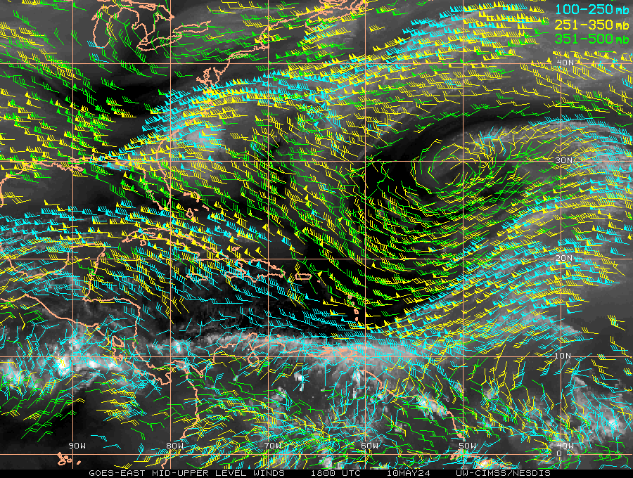
Re: Flattening of TUTT in Carribean??
Posted by JAC on 6/18/2010, 7:17 pm


101
In this thread:
Flattening of TUTT in Carribean?? - jack ruby, 6/18/2010, 5:36 pm
- Re: Flattening of TUTT in Carribean?? - jimw, 6/18/2010, 7:19 pm
- Re: Flattening of TUTT in Carribean?? - jotay3, 6/18/2010, 8:53 pm
- You'll also notice - jack ruby, 6/19/2010, 10:11 am
- Sat Pic - jack ruby, 6/19/2010, 10:12 am
- Re: Flattening of TUTT in Carribean?? - chucky7777, 6/19/2010, 2:13 am
- Re: Flattening of TUTT in Carribean?? - CypressTX, 6/19/2010, 3:45 pm
- Re: Flattening of TUTT in Carribean?? - JAC, 6/19/2010, 9:32 am
- TRMM shows convection at 22N 61W driving the TUTT in the Bahamas - JAC, 6/18/2010, 7:32 pm
- You'll also notice - jack ruby, 6/19/2010, 10:11 am
Post A Reply
This thread has been archived and can no longer receive replies.