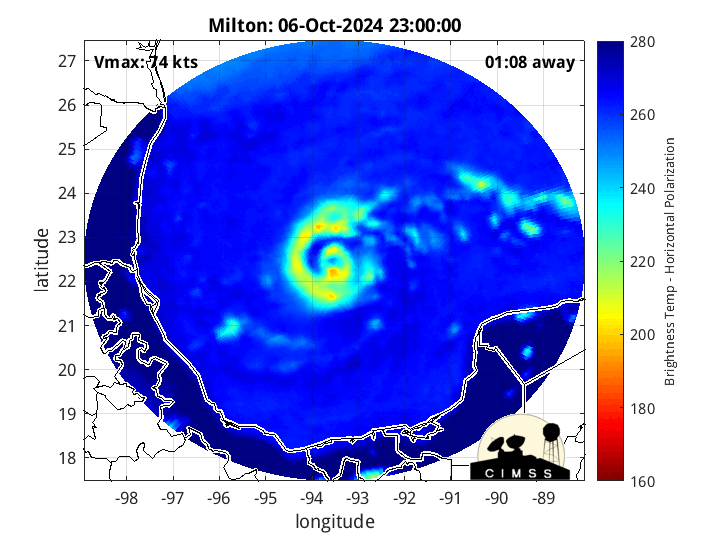
CIMSS MIMIC
Posted by cypresstx on 10/7/2024, 7:01 am
22
In this thread:
4:00 AM CDT Mon Oct 7: ESE at 8 mph: 972 mb: 100 mph - Storm Surge & Hurricane Watches Issued for Florida - cypresstx, 10/7/2024, 5:14 am
- 6:00 AM CDT Mon Oct 7: ESE at 8 mph: 954 mb: 120 mph - now Major Hurricane Milton - cypresstx, 10/7/2024, 7:26 am
- 7:00 AM CDT Mon Oct 7: ESE at 8 mph: 945 mb: 125 mph - SPECIAL ADVISORY #9 - cypresstx, 10/7/2024, 8:03 am
- 8:05 AM CDT Mon Oct 7: ESE at 8 mph: 940 mb: 150 mph - Milton now Category 4 - cypresstx, 10/7/2024, 9:13 am
- 7:00 AM CDT Mon Oct 7: ESE at 8 mph: 945 mb: 125 mph - SPECIAL ADVISORY #9 - cypresstx, 10/7/2024, 8:03 am
- NHC on Social Media - numerous options to access critical, life-saving information - cypresstx, 10/7/2024, 5:44 am
- NRL Tropical Cyclone Page - cypresstx, 10/7/2024, 6:13 am
- Craig Setzer, CCM on Milton's surge forecast - cypresstx, 10/7/2024, 6:34 am
- Craig Setzer, CCM on Milton's surge forecast - cypresstx, 10/7/2024, 6:34 am
- NRL Tropical Cyclone Page - cypresstx, 10/7/2024, 6:13 am
Post A Reply
This thread has been archived and can no longer receive replies.