In July 2009, the National Oceanic and Atmospheric Administration (NOAA) Climate Prediction Center reported that ocean temperatures in the central and eastern Pacific had shifted into El Nino anomalously warm conditions. El Nino conditions are evident in this sea surface temperature anomaly image based on data from the Advanced Microwave Scanning Radiometer for EOS (AMSR-E) on NASA Aqua satellite on July 26.
The current data are compared to long-term average temperatures (1985-1997) measured by the Advanced Very High Resolution Radiometers that have flown on several NOAA missions.
Places where temperatures were near normal are cream-colored, places where temperatures were warmer than normal are red, and places where temperatures were cooler than normal are blue. An area of dark red occupies the eastern Pacific off the coast of Peru and Ecaudor (north of Peru), indicating temperatures were much warmer than average. Meanwhile, across the Pacific, ocean temperatures around Indonesia were slightly cooler (light blue) than usual.
The Pacific is Earth's largest ocean, so it shouldn't be surprising that the Pacific's primary climate pattern: the El Nino-Southern Oscillation, which climatologists shorten to ENSO is the single biggest influence on the average temperature, rainfall, and vegetation conditions in the tropics. ENSO includes an ocean component (the El Nino/La Nina pattern) as well as an atmospheric component, the Southern Oscillation.
Every 3-8 years, the prevailing easterly winds over the eastern equatorial Pacific weaken or reverse, water temperatures in the central and eastern Pacific climb, and rainfall declines over most tropical land areas. In 1997-98, an historically strong El Nino event contributed to devastating fires in Indonesia's tropical forests. The fires released huge amounts of greenhouse gases into the atmosphere, and they led to the complete destruction of the Mentawai coral reefs west of Sumatra.
According to David Adamec, head of the Ocean Sciences Branch at NASA Goddard Space Flight Center, the development of El Nino ocean conditions isn't a guarantee that a full-blown ENSO event will grip the climate by winter. So far, he says, the atmospheric component of the pattern, the Southern Oscillation, isn't fully cooperating.
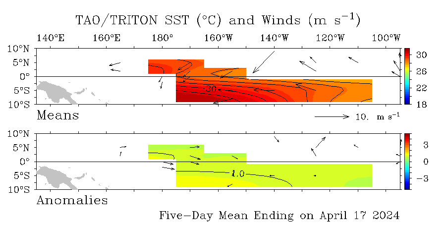
As of July 26, the trade winds in the western Pacific (near Indonesia) had shifted direction and were blowing weakly toward the east (see NOAA wind anomaly graphic below), but across the central and eastern Pacific, easterly trade winds were still of average or slightly above-average strength.
For an ENSO event to fully develop, Adamec explains, the easterly trades will have to weaken across a much wider area of the Pacific than they have at present.

|

